Monday, December 10, 2012

Scattered snow flurries today

We have a chance of a few light scattered snow flurries in the area today. Much colder weather setting in over the next few days. I will have details in a new post later tonight!
 
Stay tuned!

Saturday, December 8, 2012

Blizzard warnings in effect for SD. Still trying to level out in the hoosier state.

Alright bloggers. We have been talking about a system developing over the 10th for the past two weeks now. Its getting closer and we finally have something to track. I knew this system was going to be a big one ever sense I first saw it developing on many different weather models. The only major change is this system has lifted a few hundred miles north and west, a little more then this kind of systems usually does. So instead of us seeing some snow on the back side of this storm, we will now stay all rain.
Above is a surface chart looking into Sunday morning around 7:am EST. You can see that low pressure just to the southwest of Indiana. That warm front will keep us in the green this time around. Heavy snow bands will be only a few short miles northwest of Indiana in areas of Minnesota and SD. They're expecting blizzard conditions in areas!
 
We have a slight chance of seeing a few snow showers mix in with the rain showers, however nothing definitive at this time. Still looking like a mainly rain event for us.
 
Take a look at the National weather service map below showing all the areas just northwest of us in the blizzard warnings, winter weather watches, advisories, ETC.
We could've picked up a good 2" to 4" inches of snowfall from this system had it not lifted a few hundred miles north and west. You have no idea how much that burns me lol. I love snow and have yet to see that first inch this season!
 
Aberdeen, South Dakota, seems to be the bulls eye this time around. Take a look.
Message From The National Weather Service
"A potent winter storm will develop across the region this weekend. Heavy snow will lift across eastern South Dakota today, followed by lighter snow but increasing winds late Saturday night. By early Sunday morning, widespread blizzard conditions are expected across the northern tier of the state. Snow accumulation will range from an inch or two in central South Dakota to over 7 inches for the Sisseton hills."
 
That's right, areas in and around Aberdeen, could very well see winds gusting to 40+ mph at times with anywhere between 5" and 7" inches of snowfall. Oh how I'd love to be up there right now haha :)
~~~~~~~~~~~~~~~~~~~~~~~~~~~~~~~~~~~~~~~~~~~~~~~~~~~
 
Here's our weather break down below.
 
TONIGHT- look for mostly cloudy skies across the area with a few scattered showers likely. Rainfall tonight between .10" and .25" inches. Winds light between 10 and 15 mph. Low around 35* degrees.
 
SUNDAY- we will see rain showers across the area with a high around 54* degrees. Rainfall between .25" and .50" inches possible. Winds will be between 15 and 20 mph gusting to 25 mph at times. A high Monday around 54* degrees with a low that night around 30* degrees.
 
MONDAY- we will start out the day with cloudy skies and a few lingering rain / snow mix showers possible. Skies will try to clear as the day continues becoming partly cloudy. A high around 34* degrees and falling, followed by a low that night COLD around 19* degrees.
~~~~~~~~~~~~~~~~~~~~~~~~~~~~~~~~~~~~~~~~~~~~~~~~~~
Above is a chart looking at our average high for the month of December. You can see we will try to get close to that number over the next few days. However I do see us slightly above average once again as we head into the middle of next week. 40s return. We have another system we will track as we move closer to the 15th and 16th. It's unclear what type of precipitation will come of it at this time. However I will keep you posted. I'm hoping we will level out soon weather - wise. We need some real December weather!
 
Take care bloggers. God Bless.

Thursday, December 6, 2012

Winter is on the way! We have a busy month ahead.

I just went through a few weather models real quick and found some winter weather developing over next week! I'm talking about the cold weather returning across the area along with a very active weather pattern setting up with multiple storm chances over the next few weeks.
I have been talking about a system developing over the 10th for over a week now, and its still in my forecast today. As you can see above I have listed the three main events this month. Starting with our active weather pattern developing. This active pattern will kick off with our first system as we head closer to the 10th. I see two more systems developing from our southwest between December 14th and 21st also! With that said this allows me to go ahead and give around a 60% chance for a white Christmas this year. Now nothing is set in stone however at this time I'm liking our chances.

We will see highs fall back around normal for this time of year by the 10th. Highs will only be in the 30s with lows in the 20s. I will continue to go through data over the next few days and I will keep you posted. We have a busy month ahead of us bloggers. Stay tuned!

Monday, December 3, 2012

Rain Tonight. Active Weather Pattern Setting Up!

Above is a look at what we're tracking tonight and into Tuesday. This line of rain showers forming along a cold front will make its way through the area during the overnight hours. Along with the rain, the cold front will help us get our high temperatures closer to the average for this time of year. Its been crazy, our average high for this time of year is around 35* degrees. We have been a good 20 to 30 degrees above our average over the past few days. Once this cold front moves through the area we will see highs fall back into the 40s and 50s however this will still be a good 15 to 20 degrees above where we're suppose to be. Average low for this time of year is 20* degrees. So we have some work to do. I'm still looking for that harsh snap back to normal from nature as we head into the second week of this month.
 
I'll talk more about that here in just a second. First off lets break down the forecast for tonight.
You're looking at a surface chart for 1:am EST Tuesday. You can see that line of rain showers moving closer as well as the cold front. Right now I'm expecting rainfall sometime after 1:am. A low tonight around 53* degrees with winds between 15 and 20 mph. Gusts to 25 and 30 mph possible.
The rain showers will linger into the day hours of Tuesday before tapering off. This is a surface chart looking into Tuesday around 1:pm EST. As we head into the late afternoon and evening hours we will see the skies start to clear out a bit becoming partly cloudy to mostly clear during the overnight. A high Tuesday around 57* degrees with a low that night around 34* degrees. Winds will be between 10 and 15 mph gusting to 20 mph at times.
 
Now for that system I have been watching for the second week of December.
Here is a look at one of my weather models showing this system developing to our southwest on December 10th. I've been watching this system closely because of this strong low pressure system giving way to heavy precipitation in many areas of its path. whether it be in the form of rain or snow. This will be one to watch!
Here is another model image looking into the 11th. That colder air starts getting wrapped into this system putting us on the colder side with snow potential. After this system lifts to our northeast we will really see that cold air filter in getting our highs and lows back around where they should be for this time of year. With that said, its looking like an active weather pattern for the month of December!
This is something to watch. I will keep you posted. Have a great day bloggers.

Sunday, December 2, 2012

Nature is snapping back with cold temperatures and an active weather pattern!

Finally we have something going on in the weather world to talk about here on Justin's Indiana Weather Blog. We have been in a real calm weather pattern here in the midwest over the past few days to weeks. The biggest weather event we've talked about over the past week has been this Indian summer with highs pushing 70* degrees by this Monday! CRAZY!!! It's December 2nd and almost 70* degrees!?!? We need some cold weather to forecast, and that's just what I have in store.
 
But first off lets take a look at what we have to expect over the next 24 hours here in Indiana. Here's tonight's forecast below.
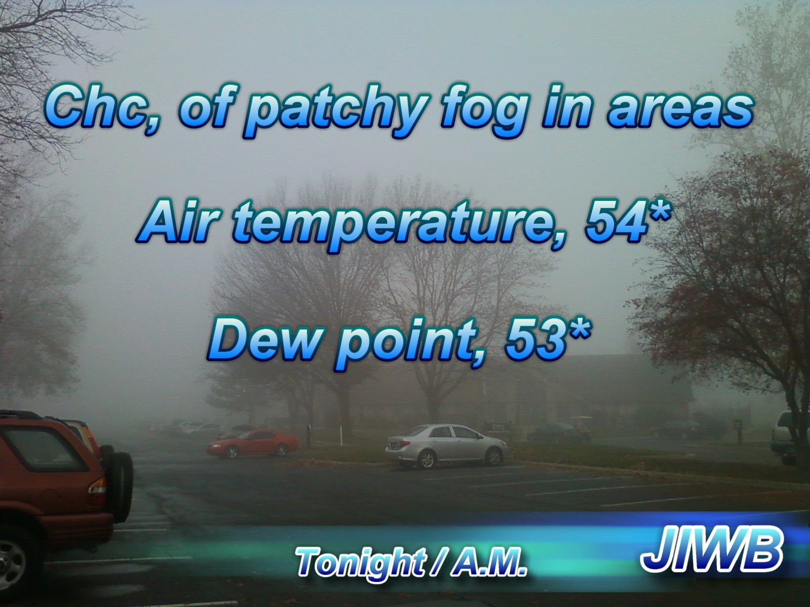
That's right, we have yet another chance at some foggy conditions across the area as we head into the overnight / early Monday morning. I'm looking for a low tonight around 54* degrees with dew points only a degree apart around 53* degrees. A light wind between 5 and 10 mph will make conditions right for fog. Mostly cloudy to partly cloudy skies across the area.
 
So when do things start to get interesting weather-wise here in the midwest? well, if you count the fog then things get interesting by as soon as tonight. If not, then by as soon as tomorrow and into Tuesday.
As we head into Monday around 7:am you can see this surface chart above showers that stationary front over the area allowing a few scattered showers to linger off and on through out much of the day. Currently for Monday I'm calling for partly cloudy to mostly cloudy skies with around a 15% percent chance of a few scattered hit and miss showers during the day hours. As we head into Monday night we will see an increase in clouds as another front approaches.
Above is a look into Monday around 7:pm EST. You can see that approaching cold front with a line of showers / thundershowers out in front. This will make its way into the area during the later hours on Monday / early Tuesday. Showers and a few thundershowers cannot be ruled out. nothing strong / severe to worry about. Rainfall is expected to be between .25" and .50" inches. Winds could pick up as we head into the overnight on Monday once this front moves in. Winds gusting anywhere between 28 and 35 mph possible. Here's your forecast break down below.
 
TONIGHT- we will see mostly to partly cloudy skies across the area. Lows will be around 54* degrees with a chance of light patchy fog in areas. Winds light between 5 and 10 mph.
 
MONDAY- expect partly to mostly cloudy skies with around a 15% percent chance of a few scattered hit and miss showers during the day hours. An increase in clouds as the day continues. Another line of showers / thundershowers move in later that night into Tuesday. Winds will be breezy between 15 and 20 mph with gusts to 25 mph. Increasing to 28 and 35 mph later that night. A high around 69* degrees with a low around 47* degrees.
 
TUESDAY- we will start the day with showers in the area as a cold front pushes off to our east. Expect a high around 58* degrees with a low Tuesday night around 36* degrees. skies will try to clear a bit as the day continues.
~~~~~~~~~~~~~~~~~~~~~~~~~~~~~~~~~~~~~
~~~~~~~~~~~~~~~~~~~~~~~~~~~~~~~~~~~~~~~~~~~~~
 
Looking ahead into the second week of December, things will start to get even more interesting! Winter will return in the area as I'm seeing a much deeper cold trying to set in. NAO and AO models indicate much cooler temps developing as the models fall into a negative phase. As this happens we are also watching a developing system as we head into the second week of December. It's looking like an active weather pattern setting up.
Above is a sneak peak into one of my weather models showing signs of a developing system during the second week of December. A strong low pressure system trying to develop and move northeast across the midwest. This system could very well be something to give way to not only heavy rain and windy conditions in the area but also snow! Now nothing is set in stone as this is looking ahead a week, however its something that has caught my attention and wanted to share.
Here's another look just a few hours later. You can see that trough of cold air plunging into the midwest just to the west of Indiana. (The blue lines). This is part of that deeper cold trying to set in. Enjoy these warmer days while you can, cause it's not going to last much longer. December is coming back strong! Weather is like a giant rubber band, The more you stretch it, "as in drifting away from the normal weather pattern, temperatures etc", The harder it snaps back into place! So even though the 60s have been nice for all the warm weather lovers, we're going to pay for it with this deep trough and active weather pattern setting up!
 
Have a great day bloggers. I'll check back soon.
 
God Bless.