
Well, data is still pretty much showing what I have already talked about in my last post however at this time I'm still thinking that the biggest tornado threat will be from I-74 south! However with that said take a look at this below.

Yes, we are starting to see those caps popping along that cold front! Just look at the storms blowing up to our south! Just amazing on the satellite!

Here is another look just a bit farther north around the IL, area. Things are really starting to pop. Right now current data shows that we are rather stable at this time however future data is expecting us to become more unstable as this low pressure system gets closer and our caps begin to pop as well.
So what is a cap? Let me see if I can break it down a bit for you.
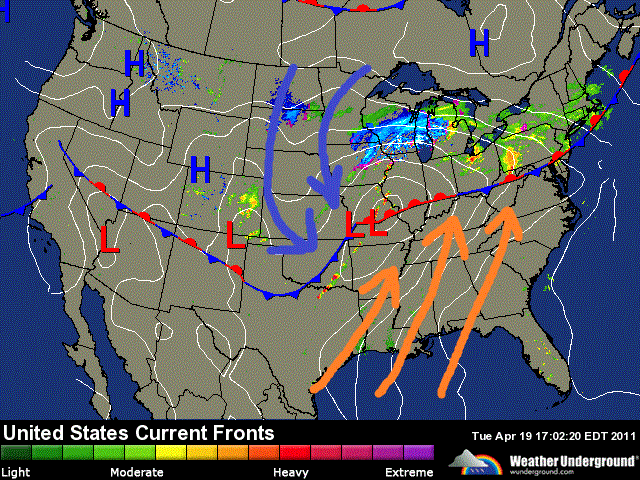
This map above is looking at where that warmer air aloft is and where that cold front is set up. Right now we have that warmer air aloft that is keeping us stable. However once this warmer air gets lifted away it will allow these storms to start popping across the area! Just like we're seeing to our west and southwest in the satellite images above. Think of it as a bottle of soda. When you shake it with the cap on nothing happens other then a lot of pressure build up. But once that cap gets removed the soda blows up out of the bottle.
Right now I still look for the highest severe threat to be from I-74 south at this time. Meaning the best place for tornadoes to develop. The more south and southwest you go the higher the threat!

But we're not out of the woods. I still will not rule out the chance of an isolated tornado at this time. However wind damage is also a big threat! winds gusting to 30 mph possible outside of storms and even higher in storms. Also frequent lighting and a few hailers are likely in the area. Heavy rainfall and flash flooding is a threat tonight. Rainfall between 1" and 2" inches with locally higher amounts in thunderstorms.
I look for the storms to be popping around the area between the times of 8:pm and 2:am EDT. It's gonna be a late night on the blog bloggers!
I'll continue to check back as needed with updates!
God Bless!
2 comments:
Thanks again for the update. Yeah I am not a big fan of any storm like this let alone the ones during the night...just messes me up for work the next day and puts me in zombie mode. lol.
Those satellite images are pretty cool. :)
I'll be following the blog all night so keep up the good work!
Thanks Justin and thank you for explaining about the caps. Very interesting! Take care, God bless you and be safe all! JLB
Post a Comment