
Severe thunderstorm Watch is in effect Until 9:24pm EDT
INDIANA COUNTIES INCLUDED ARE
CARROLL
MONTGOMERY
TIPPECANOE WARREN
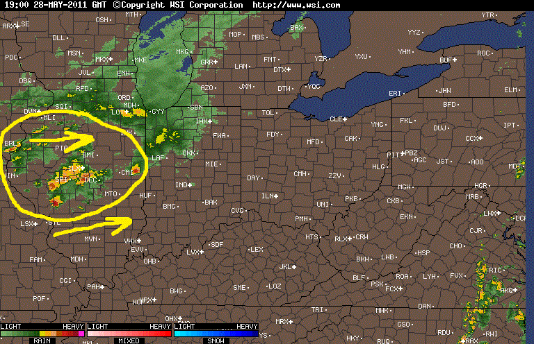
This severe thunderstorm Watch is in effect because of all the scattered storms you see in the image above off to our west in areas of IL. some of these cells do have severe thunderstorm warnings with them. However the only type of storm reports I have recived out of these cells has been hail anywhere between 1.00" inch to 1.75" inches in size. So we will continue to watch as they move closer and I'll keep you all posted as needed.

The only severe thunderstorm warned cell in the WLFI viewing area is the one you see above.
* SEVERE THUNDERSTORM WARNING FOR...
FOUNTAIN COUNTY IN WEST CENTRAL INDIANA...
NORTHWESTERN MONTGOMERY COUNTY IN WEST CENTRAL INDIANA...
SOUTHWESTERN WARREN COUNTY IN WEST CENTRAL INDIANA...
* UNTIL 345 PM EDT
No comments:
Post a Comment