Just got a report from Fountain, county saying that they are receiving just your basic thunderstorm. Thunder lightning and light to moderate rainfall. Well, this is what we are expected to get in areas of Tippecanoe, White, Carroll, Clinton, and Montgomery counties over the next few hours! Now the more north you go into counties such as Benton, Newton, and Jasper, counties this is where you have a higher flood threat! You will see much heavier rains in the moderate to heavy range with your basic thunderstorm.
Severe weather is still staying south of Montgomery county which is good news for the WLFI viewing area! Areas around Terre haute, and east of there is getting hit hard with severe thunderstorm warnings and even some tornado warnings in areas of bloomington, IN. God bless them and keep them all safe!

Tuesday, June 15, 2010


Could the weather models have been spot on?
Currently looking like the models could be spot on with the placement of the severe weather! Take a look below... Radar image taken at 6:28pm EDT This is where they were showing the High CAPE values along with the EHI, and Helicity! All things needed for severe weather development and possible tornadoes. Still we are keeping watch on the weather to impact our area. We should be seeing rain or hearing thunder closer to 6:50pm or 7:00pm EDT here in the Lafayette area. Currently looking like flooding could be the main threat here in the WLFI viewing area. Still expect some gusty winds possible, Moderate to heavy rainfall, And lightning is a threat with any storm...
This is where they were showing the High CAPE values along with the EHI, and Helicity! All things needed for severe weather development and possible tornadoes. Still we are keeping watch on the weather to impact our area. We should be seeing rain or hearing thunder closer to 6:50pm or 7:00pm EDT here in the Lafayette area. Currently looking like flooding could be the main threat here in the WLFI viewing area. Still expect some gusty winds possible, Moderate to heavy rainfall, And lightning is a threat with any storm...Stay tuned.
Strong Stuff May Stay South!
Radar image taken at 6:20pm EDT...
 We have so many severe thunderstorm warnings out with this system currently just starting to make it's way over the Indiana state line it's not even funny! But I have gone through the latest weather data and here's what I came up with!
We are still looking at lifted index at -1.8 and models are expecting them to fall just a little more between -2 and -3. Yes, this is still unstable enough to support these severe thunderstorms! Now I have also gone over the CAPE values and the EHI. They are both showing the worst to possibly stay from Tippecanoe county south. Now I'm not saying we won't see a stray strong storm or two as that is still very possible! But even looking at the radars right now the real strong stuff is staying south of Montgomery county! This is good news for the Viewing area.
Still we can expect to see moderate to heavy rainfall along with a few gusty winds between 30 and 40 mph possible. Flooding will be a threat! And frequent lightning!
 We have so many severe thunderstorm warnings out with this system currently just starting to make it's way over the Indiana state line it's not even funny! But I have gone through the latest weather data and here's what I came up with!
We are still looking at lifted index at -1.8 and models are expecting them to fall just a little more between -2 and -3. Yes, this is still unstable enough to support these severe thunderstorms! Now I have also gone over the CAPE values and the EHI. They are both showing the worst to possibly stay from Tippecanoe county south. Now I'm not saying we won't see a stray strong storm or two as that is still very possible! But even looking at the radars right now the real strong stuff is staying south of Montgomery county! This is good news for the Viewing area.
Still we can expect to see moderate to heavy rainfall along with a few gusty winds between 30 and 40 mph possible. Flooding will be a threat! And frequent lightning!
If The Models Are Right?!?!
Okay bloggers, I have some weather model data to talk to you all about. Here are some Forecast weather models below and what they mean.
Lifted Index is expected to fall to or around -3. Anything around -4 is pretty unstable and allows severe thunderstorm development!
Total Totals models are expected to rise to or around 53, Which means Scattered Heavy Storms.
SWEAT models are expected to rise to or around 350, which anything at 300 or above means we have severe thunderstorm potential.
EHI is expected to be around 1, which it usually needs to be around 1 to 2 for thunderstorm development.
And we are looking at an 80% chance for thunderstorms this evening / tonight.
So after looking at these models and where they're expected to be later on this evening I'm going ahead and telling you that if this indeed happens then we will have some strong weather to track this evening / tonight. The sun has been out for the past half hour / 45 minutes or so which isn't helping any. The dew points are even going up as I type! All we can do for now is continue to watch the radars and data and keep each other updated!
This could be a long evening if the models are right!
Stay Tuned......
Lifted Index is expected to fall to or around -3. Anything around -4 is pretty unstable and allows severe thunderstorm development!
Total Totals models are expected to rise to or around 53, Which means Scattered Heavy Storms.
SWEAT models are expected to rise to or around 350, which anything at 300 or above means we have severe thunderstorm potential.
EHI is expected to be around 1, which it usually needs to be around 1 to 2 for thunderstorm development.
And we are looking at an 80% chance for thunderstorms this evening / tonight.
So after looking at these models and where they're expected to be later on this evening I'm going ahead and telling you that if this indeed happens then we will have some strong weather to track this evening / tonight. The sun has been out for the past half hour / 45 minutes or so which isn't helping any. The dew points are even going up as I type! All we can do for now is continue to watch the radars and data and keep each other updated!
This could be a long evening if the models are right!
Stay Tuned......
Why The Severe Weather Watch? I'll Tell You!
So we have that severe thunderstorm watch in effect until 9:00pm CDT 10:00pm EDT tonight but why is it in effect if we're not seeing anything severe?? Well, let me go ahead and point out that no we are not seeing anything severe at this time! Just some rain / thundershowers moving through the area. However this could change as the evening goes on! We have a lot of scattered moderate to severe thunderstorms popping up southwest of IL, and they are moving north north east! If we become a little more unstable then these storms could very well hold together and make it up to the WLFI viewing area! Take a look at what I'm talking about in this radar image below.
This is the reason we have been put under a severe thunderstorm watch until 10:00pm EDT tonight. We will all have to be here to keep everyone updated through out this weather event. Right now models are telling me we have around a 45% chance for dangerous winds if these storms do in fact hold together and move through the area. Currently the K-Index models are showing me around a 60% to 80% chance for thunderstorms this evening. This is a pretty good number. Right now the EHI models which is used along with CAPE to find where the real or highest chance for severe weather would set up is showing me just to the south of Lafayette, However it is close! Right now the tornado threat is around 5%. And hail in the area is also a low 15% chance. Now south of Lafayette, is a different story! I think they will have the highest chance for Hail, Wind, And Isolated Tornadoes, Still we need to stay storm ready and keep a close watch! Like I said this is close to home and as we seen yesterday severe weather has a mind of it's own.
Here's a look at the current severe weather outlook map below.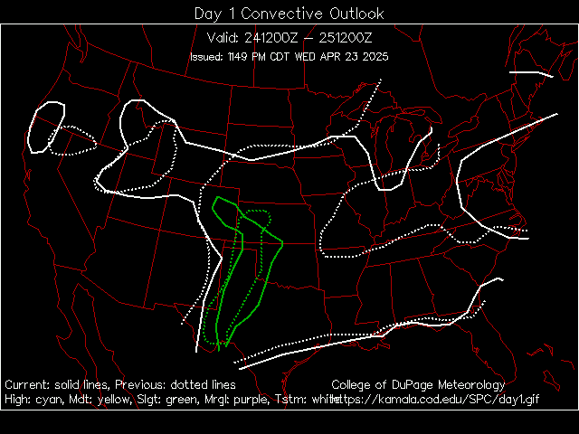
You can see in the green areas is the slight risk. The yellow area is the moderate risk for severe weather. See how close to home it is??
You can bet that I'll do my best to be here giving in storm updates as usual. So stay tuned and I will check back.
Subscribe to:
Posts (Atom)